Stay Out of the Ocean This Weekend: 7- to 11-Foot Waves and Dangerous Rip Currents at Northeast Florida Beaches
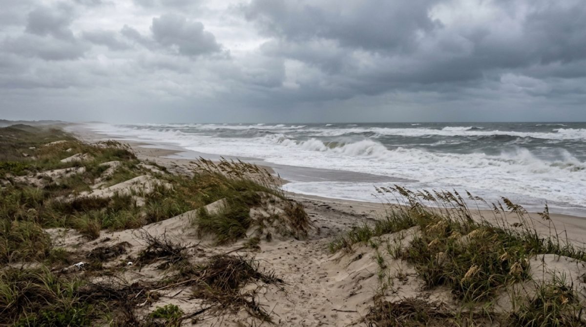
Breaking waves of 7 to 11 feet are expected at Northeast Florida beaches through 8 p.m. Monday. (AI illustration, not a real scene.) Illustration: AI-generated
Jacksonville, Fla. — Stay out of the ocean this weekend. The National Weather Service expects breaking waves of 7 to 11 feet and dangerous rip currents at Northeast Florida beaches from Saturday, Oct. 24, through 8 p.m. Monday, Oct. 26.
A high surf advisory, a high rip current risk and a coastal flood warning are all in effect for the Jacksonville-area beaches, St. Johns County and Flagler County. Offshore, a gale watch calls for seas of 10 to 16 feet.
The warnings at a glance
| Hazard | When | What to expect |
|---|---|---|
| High surf advisory | 8 a.m. Saturday to 8 p.m. Monday | Breaking waves of 7 to 11 feet |
| High rip current risk | Through 8 p.m. Monday | Currents that can pull swimmers away from shore |
| Coastal flood warning | 5 a.m. Saturday to 8 p.m. Monday | Flooding on low roads at high tide, worst near the Sunday and Monday morning high tides |
| Strong coastal wind | Saturday afternoon into Monday | Gusts of 35 to 45 mph |
| Gale watch (coastal waters) | Saturday through Monday | Offshore seas of 10 to 16 feet |
Waves up to 11 feet
The high surf advisory covers coastal Duval, coastal Flagler, northeast and southeast coastal St. Johns and the southeast Georgia beaches.
The weather service expects "large breaking waves of 7-11 ft."
Rip currents can take anyone
The high rip current risk runs through 8 p.m. Monday for coastal Duval, Flagler and St. Johns counties.
The weather service's warning is blunt: "rip currents can sweep even the best swimmers away from shore into deeper water."
The safest choice is simple. Stay out of the water until conditions improve.
If you get caught in a rip current
Standard advice from the National Weather Service and the U.S. Lifesaving Association:
- Stay calm. Don't fight the current.
- Don't swim straight back to shore against it.
- Swim parallel to the shore until you're out of the current, then swim back at an angle.
- If you can't get out, float or tread water to save energy.
- Wave your arms and yell for help.
If you see someone else caught in a rip current, don't go in after them. Call 911 and throw them something that floats.
Beach roads can flood, too
The coastal flood warning runs from 5 a.m. Saturday to 8 p.m. Monday. Beach-area roads may flood at high tide, and the city of Jacksonville expects the highest water near the Sunday and Monday morning high tides.
Never drive through floodwater. Turn around and find another way.
Wind and boating
The city expects coastal gusts up to 45 mph from Saturday afternoon through Sunday. St. Johns County expects gusts of 35 to 45 mph, peaking Sunday into Monday.
With a gale watch and 10- to 16-foot seas offshore, St. Johns County advises boaters to postpone trips when conditions are unsafe and to keep an eye on marine advisories.
What to do now
- Stay out of the surf through at least Monday evening.
- Avoid flood-prone spots at high tide.
- Put off boat trips until marine conditions improve.
- Secure loose outdoor items before the strongest wind arrives.
Where to get alerts
- Duval County: Sign up for ALERTJAX at JaxReady.com/ALERTJAX. Report downed power lines or hazardous trees in Jacksonville at 904-630-CITY (2489).
- St. Johns County: Sign up for Alert St. Johns on the county's Emergency Management page, and follow St. Johns County Emergency Management on Facebook.
- Forecasts: National Weather Service Jacksonville at weather.gov/jax.
When will it be safe?
The surf advisory, rip current risk and flood warning are all set to end at 8 p.m. Monday. That doesn't mean the ocean will be calm the minute they expire, so check the latest forecast before you go back in.
How we did this
This story is based on National Weather Service Jacksonville alerts issued Oct. 23, 2026, and weather releases from the City of Jacksonville and St. Johns County the same day. Rip current advice follows standard National Weather Service and U.S. Lifesaving Association guidance.
Source: National Weather Service Jacksonville; City of Jacksonville and St. Johns County releases (Oct. 23, 2026)
News organizations may republish this story with credit. See our guidelines.
Know someone who'd want to read this? Email it to a friend.
Own a Jacksonville business? Introductory ad rates from $125/month. See ad optionsPlan your weekend with Jax Times
Get This Weekend in Jacksonville every Thursday: the best local events, free things to do and family fun, plus each evening's local news. Free, and you can unsubscribe anytime.
Most read this week
- Florida's 3 Constitutional Amendments on the Nov. 3 Ballot, Explained in Plain English
- Florida Is Holding $3 Billion in Unclaimed Money. Here's How Jacksonville and St. Augustine Residents Can Search for Free
- Fire Destroys Golf Carts of St. Augustine Building on U.S. 1: What We Know, What Happens Next and 9 Golf Cart Battery Safety Rules
- St. Augustine Artist Dara Dodson Paints 'A Land Remembered,' With Shows at the Karpeles Museum and the St. Augustine Art Association
- St. Augustine Parking in 2026: 12 Questions About the $20 Garage, $3 Resident Rate and Cheaper Options
More stories
 Local Jacksonville's Fort Caroline Memorial Is Moving to Higher Ground: What's Changing and the 1564 Story Behind It
 Local Jacksonville Small Claims Court in 2026: 8 Steps to Sue for Up to $8,000, With Filing Fees From $55 to $300
 Local Jacksonville Jury Duty in 2026: 10 Questions About $15 Pay, $30 Days and Who Can Be Excused
 Local Jacksonville's 228-Year-Old Plantation House: Anna Kingsley's Remarkable Life and the 25 Surviving Slave Cabins
Comments
Be respectful. No personal attacks, hate speech, spam or anyone's private information. Every comment is reviewed before it appears. Comment rules
No comments yet. Be the first to share your thoughts.