St. Johns River by the Numbers: 310 Miles, a Northward Flow and Less Than 30 Feet of Drop
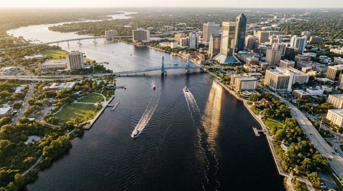
The St. Johns River runs 310 miles and flows north to the Atlantic at Mayport. Illustration: AI-generated
Jacksonville, Fla. - The St. Johns River stretches 310 miles across Florida, flows north instead of south and drops less than 30 feet from its beginning near Vero Beach to the Atlantic Ocean at Jacksonville. It connects lakes, springs, wildlife habitat and communities across a drainage basin covering 8,840 square miles.
Despite its size, the river moves slowly. Its overall flow averages about 0.3 mph, earning it a reputation as a "lazy" river.
From changing salt levels around Jacksonville to tides felt more than 160 miles inland, here is a closer look at the St. Johns River through the numbers.
1. The river stretches 310 miles and flows north
The St. Johns begins in the St. Johns Marsh near Vero Beach in Indian River County, at an elevation of about 30 feet.
From there, it travels north to the Atlantic Ocean near Mayport in Duval County.
Across all 310 miles, the water drops less than 30 feet, about 0.8 inch per mile. That gentle slope helps explain why the river moves so slowly.
2. A watershed covering 8,840 square miles
The river's drainage basin covers about 8,840 square miles. It touches or borders 12 Florida counties, including Brevard, Osceola, Orange, Lake, Volusia, Seminole, Putnam, St. Johns, Clay and Duval.
About 3.5 million people live in the river's watersheds, which shows why the St. Johns matters far beyond Jacksonville.
3. Its widest stretches are near home
The river changes a lot in width as it moves north.
Between Lake George and Palatka, it ranges from about 600 feet to 2,640 feet wide. Between Palatka and Jacksonville, it widens to about 1 to 3 miles across. Its widest point is about 3 miles.
The shipping channel north of Jacksonville is much narrower: 400 to 900 feet wide and 40 feet deep.
St. Johns River: The numbers at a glance
| Measurement | Figure |
|---|---|
| Total length | 310 miles |
| Flow direction | North |
| Elevation at source | 30 feet |
| Total drop | Less than 30 feet |
| Average slope | About 0.8 inch per mile |
| Overall flow speed | About 0.3 mph |
| Drainage basin | 8,840 square miles |
| Counties touched or bordered | 12 |
| Watershed population | About 3.5 million |
| Widest point | About 3 miles |
| Tidal reach | 161 miles upstream |
| Fish species in the system | 183 |
| Bridges in Jacksonville | 7 |
4. Tides push 161 miles inland
Although the St. Johns flows north, Atlantic tides affect it far upstream. Tidal influence reaches about 161 miles inland to Lake Monroe and occasionally to Lake Harney.
At Mayport, average discharge is about 15,000 cubic feet per second. With tides, it can top 50,000. After heavy rain combined with tides, it can reach 150,000 cubic feet per second, 10 times the average.
5. Big lakes, and about 3,500 smaller ones
The upper basin holds about 3,500 lakes. Three big ones stand out:
| Lake | Surface area | Other measurements |
|---|---|---|
| Lake George | 72 square miles | 6 miles wide, 12 miles long |
| Lake Monroe | 15 square miles | Average depth of 8 feet |
| Lake Harney | 9 square miles | Occasionally reached by tides |
Lake George is nearly five times the size of Lake Monroe and eight times the size of Lake Harney.
6. Blue Spring pumps more than 64 million gallons a day
Blue Spring releases more than 64 million gallons of water a day, at a constant 72 degrees.
7. Salt levels change a lot around Jacksonville
How salty the river is depends on where you measure it.
| Location | Salinity (parts per thousand) |
|---|---|
| Downtown Jacksonville | 11.40 |
| Buckman Bridge | 2.90 |
| Shands Bridge | 0.81 |
| Ocean water | More than 35 |
| Fresh water | Under 2 |
Near downtown, the river is a mix of salt and fresh water. By the Shands Bridge, it measures as fresh.
8. Wildlife includes 183 fish species
The St. Johns system supports 183 fish species, including 55 in the main river.
Birds are plentiful too. One study counted about 60,000 birds in the upper basin in a single month.
9. Human history stretches back thousands of years
People lived along the St. Johns 5,000 to 3,000 years ago, during the Middle Archaic period. About 14,000 Timucua lived in the region at the time of European contact.
| Year or period | Event |
|---|---|
| 5,000-3,000 years ago | People living along the river |
| 1513 | Ponce de Leon |
| 1562 | Jean Ribault |
| 1564 | Fort Caroline established |
| 1565 | Fort Caroline captured |
| 1680-1700 | Current name appears on a Spanish map |
| 1763 | Britain takes control |
| 1765-1766 and 1773-1777 | Naturalist William Bartram explores |
| 1821 | Florida becomes a U.S. territory |
| 1860s | Steamboat era peaks |
| 1864 | USS Columbine and the Maple Leaf sink during the Civil War |
| 1994 | Maple Leaf recovered |
| 1998 | Named an American Heritage River |
| 2008 | Listed on an "endangered rivers" list |
10. The port shows the river's economic muscle
According to the article's figures, Jacksonville's port handles about 18 million short tons of cargo a year, with a local economic impact of $1.38 billion and about 10,000 jobs.
Seven bridges cross the river in Jacksonville.
Quick Q&A
Does the St. Johns really flow north? Yes. It starts near Vero Beach and empties into the Atlantic at Mayport.
Why is it so slow? It drops less than 30 feet over 310 miles, about 0.8 inch per mile.
How far inland do tides reach? About 161 miles, to Lake Monroe and sometimes Lake Harney.
What the numbers mean for Jacksonville
The St. Johns is more than the stretch of water running through downtown. Its 310 miles tie Jacksonville to a network of lakes, springs and waterways across Florida. Its gentle slope explains its slow pace, and its changing width, flow and salt levels mean the river can look and behave very differently from one spot to the next.
How we did this
Jax Times compiled the measurements, dates, wildlife figures and Jacksonville shipping numbers from Wikipedia's "St. Johns River" article, reviewed Oct. 23, 2026. The figures are the article's, not new field measurements or updated port statistics.
Source: Wikipedia, "St. Johns River" (reviewed Oct. 23, 2026)
News organizations may republish this story with credit. See our guidelines.
Know someone who'd want to read this? Email it to a friend.
Own a Jacksonville business? Introductory ad rates from $125/month. See ad optionsPlan your weekend with Jax Times
Get This Weekend in Jacksonville every Thursday: the best local events, free things to do and family fun, plus each evening's local news. Free, and you can unsubscribe anytime.
Most read this week
- Florida's 3 Constitutional Amendments on the Nov. 3 Ballot, Explained in Plain English
- Florida Is Holding $3 Billion in Unclaimed Money. Here's How Jacksonville and St. Augustine Residents Can Search for Free
- Fire Destroys Golf Carts of St. Augustine Building on U.S. 1: What We Know, What Happens Next and 9 Golf Cart Battery Safety Rules
- St. Augustine Artist Dara Dodson Paints 'A Land Remembered,' With Shows at the Karpeles Museum and the St. Augustine Art Association
- St. Johns Is Florida's Fastest-Growing County, Adding 36 People a Day, as Northeast Florida Passes 2 Million
More stories
 Local Phase III Water Restrictions: Your 1 Watering Day by Address, the 10 Hours You Can't Water and What's Exempt
 Local Stay Out of the Ocean This Weekend: 7- to 11-Foot Waves and Dangerous Rip Currents at Northeast Florida Beaches
 Local Coastal Flood Warning for Jacksonville: Water Peaks Sunday and Monday Mornings in 5 Flood-Prone Areas
 Local Hurricane Dora Hit St. Augustine With 110 MPH Winds in 1964: Northeast Florida's Benchmark Storm
Comments
Be respectful. No personal attacks, hate speech, spam or anyone's private information. Every comment is reviewed before it appears. Comment rules
No comments yet. Be the first to share your thoughts.