Northeast Florida Flood Warning Extended to Friday, Now Includes St. Johns River

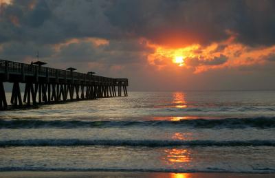
A surfer rides a wave at sunrise near the Jacksonville Beach Pier (file photo). Photo: Eric Johnson / Wikimedia Commons (CC BY-SA 3.0)
JACKSONVILLE, Fla. - The National Weather Service has extended Northeast Florida's coastal flood warnings until 2 a.m. Friday, Oct. 30, and a separate warning also covers parts of the St. Johns River basin. The warnings include coastal communities in Nassau, Duval, St. Johns and Flagler counties, along with several inland areas near the river. Forecasters warn that moderate flooding could occur during times of high tide, potentially closing numerous roads and flooding low-lying properties.
Jax Times reported Sunday, Oct. 25, that the coastal flood warning would remain in effect until 5 a.m. Wednesday. The National Weather Service has since extended the warnings again, and the latest versions, issued at 3:33 a.m. Tuesday, Oct. 27, run until 2 a.m. Friday. Those warnings also identify areas along the St. Johns River where moderate flooding could occur.
The biggest concern centers on the high tide periods Tuesday through Thursday, when water levels may rise enough to affect roads, homes, businesses and some critical infrastructure. The weather service also warns of shoreline erosion as elevated water levels continue. Residents in flood-prone locations should pay particular attention to the morning and nighttime high tides.
Coastal Flood Warning Covers Five Areas
The coastal flood warning covers coastal Nassau, coastal Duval, coastal Flagler, Northeast coastal St. Johns and Southeast coastal St. Johns counties. It remains in effect until 2 a.m. Friday, Oct. 30, with the National Weather Service forecasting "moderate flooding during times of high tide." The warning covers Tuesday, Wednesday and Thursday, making the predicted tide schedules important for residents planning travel or protecting property.
The National Weather Service says numerous roads may be closed as flooding develops. Low-lying property, including homes, businesses and some critical infrastructure, may be inundated. Shoreline erosion is another possible impact during the warning period.
The warning does not mean that every street or neighborhood in the affected areas will flood. It identifies the potential for flooding, particularly around high tide, across the named coastal areas. Drivers should check local conditions and avoid any roadway where water is covering the pavement.
St. Johns River Basin Now Under a Separate Warning
A separate coastal flood warning covers the St. Johns River basin, including Eastern Clay, Trout River, South Central Duval and Western St. Johns. Inland Flagler and Eastern Putnam are also included in that warning, which continues until 2 a.m. Friday. The National Weather Service expects moderate flooding during times of high tide in the affected river basin areas.
The river warning carries many of the same concerns as the coastal warning. Numerous roads may be closed, and floodwater may inundate low-lying homes, businesses and some critical infrastructure. The weather service also identifies shoreline erosion as a possible impact.
The timing of high tide differs between the beaches and the riverfront in downtown Jacksonville. NOAA predictions show that the St. Johns River at the Southbank Riverwalk reaches high tide roughly 30 to 60 minutes after the nearby beach locations. That difference matters because flooding associated with high tide may develop at different times along the coast and river.
Tuesday and Wednesday High Tide Times
NOAA's predicted tides provide a practical guide to when water levels normally reach their daily peaks. The following times cover Tuesday, Oct. 27, and Wednesday, Oct. 28, at four locations across Northeast Florida. All heights are NOAA astronomical tide predictions measured in feet relative to mean lower low water, or MLLW.
| Location | Tuesday, Oct. 27 | Wednesday, Oct. 28 |
|---|---|---|
| Mayport (Bar Pilots Dock) | 9:58 a.m. (6.2 ft) | 10:48 a.m. (6.2 ft) |
| Mayport (Bar Pilots Dock) | 10:21 p.m. (5.2 ft) | 11:12 p.m. (5.1 ft) |
| Fernandina Beach | 10:10 a.m. (7.8 ft) | 11:03 a.m. (7.8 ft) |
| Fernandina Beach | 10:33 p.m. (6.6 ft) | 11:27 p.m. (6.4 ft) |
| St. Augustine Beach | 9:21 a.m. (6.5 ft) | 10:10 a.m. (6.5 ft) |
| St. Augustine Beach | 9:46 p.m. (5.2 ft) | 10:36 p.m. (5.0 ft) |
| St. Johns River, Southbank Riverwalk | 10:55 a.m. (2.9 ft) | 11:42 a.m. (2.8 ft) |
| St. Johns River, Southbank Riverwalk | 11:33 p.m. (2.7 ft) | (after midnight) |
These figures represent normal astronomical tide predictions, not the maximum water levels expected during the flood warning. Actual water levels can rise higher than the published predictions because of wind and waves. Residents should not interpret the listed heights as limits on how high water could reach during the warning.
The morning high tides will arrive between 9:21 a.m. and 10:55 a.m. Tuesday at the four listed locations. On Wednesday, the predicted morning high tides range from 10:10 a.m. at St. Augustine Beach to 11:42 a.m. along the Southbank Riverwalk. Evening and nighttime high tides also deserve attention because the coastal flood warnings remain active through Thursday night.
Why Tide Timing Matters for Flooding
The National Weather Service specifically links the expected flooding to high tide periods. That makes the NOAA predictions useful for identifying when residents should be especially alert to rising water. However, the predictions alone cannot determine which individual roads, buildings or properties will experience flooding.
Fernandina Beach has a predicted Tuesday morning high tide of 7.8 feet, while Mayport's prediction is 6.2 feet. St. Augustine Beach has a predicted morning high tide of 6.5 feet on both Tuesday and Wednesday. Because these are location-specific tidal measurements, the figures should not be used to compare flooding severity directly between communities.
Along the St. Johns River at the Southbank Riverwalk, NOAA predicts a Tuesday morning high tide of 2.9 feet and a late-night high tide of 2.7 feet. Wednesday's predicted morning peak is 2.8 feet at 11:42 a.m. The separate river flood warning makes these periods particularly important for people in low-lying locations along the affected river basin.
High Surf and Dangerous Rip Currents Continue
Flooding is not the only weather hazard affecting Northeast Florida's coast this week. A High Surf Advisory is in effect until 2 a.m. Friday, Oct. 30, with breaking waves of 7 to 10 feet expected along Northeast Florida beaches. The National Weather Service warns of dangerous swimming and surfing conditions and localized beach erosion. A separate rip current statement warns of a high rip current risk until 2 a.m. Friday.
The weather service warns that rip currents can sweep even strong swimmers away from shore and into deeper water. Dangerous swimming and surfing conditions are expected during the advisory period. Localized beach erosion is also possible as the high surf continues.
Residents and visitors should stay out of the ocean while these dangerous conditions persist. The flood warning and high surf advisory address different hazards, but both affect coastal safety during the same period. Conditions at the beaches may remain dangerous even where nearby roads are not flooded.
What Residents Should Do Before High Tide
People who live or travel through low-lying areas should prepare before the next high tide rather than waiting until water reaches a roadway. Moving vehicles from low spots ahead of the morning high tides may help avoid flooding problems. Residents should also pay attention to the nighttime tides because the warnings continue through Thursday night.
Drivers should never attempt to cross flooded roads. The National Weather Service warns that numerous roads may be closed, but the warnings do not identify specific streets that are already closed. Residents can check JaxReady or their local emergency management agency for road closure information.
The same general precautions apply to communities along the St. Johns River and in the affected coastal counties. The river basin warning specifically identifies moderate flooding as a concern, and the coastal warning now also calls for moderate flooding. Both warnings remain in effect until 2 a.m. Friday unless the National Weather Service changes them.
What Happens Next
The current Northeast Florida coastal and river flood warnings are scheduled to expire at 2 a.m. Friday, Oct. 30. However, the National Weather Service may adjust or extend the warnings as conditions change. Residents should monitor updated forecasts rather than assuming the flooding threat will end at the currently listed expiration time.
The immediate focus is on the high tides from Tuesday through Thursday, including both morning and nighttime peaks. Anyone traveling through low-lying areas should remain alert to potential road flooding, while beachgoers should avoid the ocean because of the high surf and rip current risk. Updated warnings and forecasts are available from the National Weather Service Jacksonville office.
How we did this
Jax Times used coastal flood warnings, the St. Johns River basin flood warning and marine hazard information issued by the National Weather Service Jacksonville at 3:33 a.m. Tuesday, Oct. 27, 2026, through api.weather.gov. High tide times and predicted heights came from NOAA Tides and Currents predictions retrieved Oct. 26, using the MLLW tidal datum. We also compared the latest warning expiration times with the warning information Jax Times reported Sunday, Oct. 25, to identify the extension through early Friday.
Sources: National Weather Service Jacksonville (Oct. 26, 2026); NOAA Tides and Currents

News organizations may republish this story with credit. See our guidelines.
Know someone who'd want to read this? Email it to a friend.
Own a Jacksonville business? Introductory ad rates from $125/month. See ad options Follow Jax Times on FacebookLocal news, events and people, in your feed every day.Most read this week
- Florida's 3 Constitutional Amendments on the Nov. 3 Ballot, Explained in Plain English
- Coastal Flood Warning for Jacksonville: Water Peaks Sunday and Monday Mornings in 5 Flood-Prone Areas
- Florida Is Holding $3 Billion in Unclaimed Money. Here's How Jacksonville and St. Augustine Residents Can Search for Free
- Jacksonville Fair 2026 Guide: Dates, Gate Times, Ticket Prices, Free Days and Every Concert (Nov. 5-15)
- Fire Destroys Golf Carts of St. Augustine Building on U.S. 1: What We Know, What Happens Next and 9 Golf Cart Battery Safety Rules
More stories
 Local Duval Has 82,418 Veterans, While Clay Has Northeast Florida's Highest Share at 1 in 7 Adults
 Local LaVilla, Jacksonville's 'Harlem of the South': A Former Town, the Ritz and a Historic Anthem
 Local Jacksonville Skyway Stops Running Nov. 2: Last Week to Ride and What Changes for JTA Riders
 Local Jacksonville Beach Pier by the Numbers: 1,300 Feet, 2 Hurricanes, a 6-Year Rebuild and a $2.50 Walk
Comments
Be respectful. No personal attacks, hate speech, spam or anyone's private information. Every comment is reviewed before it appears. Comment rules
No comments yet. Be the first to share your thoughts.