Manatee Speed Zones on the St. Johns River in Jacksonville: Where Boats Must Slow Down Year-Round, From Main Street to Julington Creek
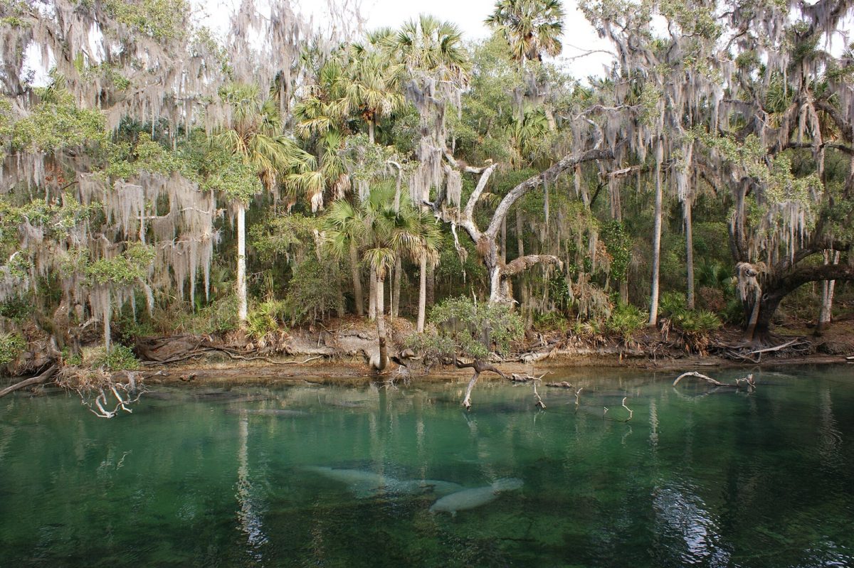
Duval County manatee speed zones on the St. Johns River are in effect year-round. See where boats must slow down, from Main Street to Julington Creek. Shown: Manatees gathered in the clear spring run at Blue Spring State Park, a St. Johns River tributary in Central Florida (file photo, not Jacksonville). Photo: Bkamprath / Wikimedia Commons (Public domain)
JACKSONVILLE, Fla. - Boaters on the St. Johns River in Duval County must follow manatee speed zones all year, not only in the cooler months. State rule 68C-22.027 says: "All of the zones set forth below are in effect year-round." That includes the stretch from the Main Street Bridge to the Fuller Warren Bridge, where boats must go slow shore to shore, and the creeks up to Julington Creek.
The rule is titled "Duval County and Associated County (Parts of Clay and St. Johns) Zones." Cooler water is when many boaters start asking which rule applies on the river. In Duval County, the answer in the rule text is that the listed zones apply all year. This guide summarizes the zones, and boaters should rely on posted signs and official maps for exact boundaries.
The three kinds of zones
The rule sets up three categories: Slow Speed, Shore-to-Shore; Slow Speed; and 25 MPH. There are no idle zones in the Duval County rule. Counting the numbered entries in the rule text, there are 4 shore-to-shore slow speed areas, 11 slow speed areas and 2 areas with a 25 MPH limit.
Those counts come from the numbered entries in the Cornell copy, and they should be rechecked against the current state rule before anyone relies on them. The zone names in this guide are summaries. The boundaries are defined by landmarks in the rule text and on Florida Fish and Wildlife Conservation Commission (FWC) maps.
The rule history is also worth noting. The rule history on the Cornell copy reads: new 12-22-92, amended 6-16-93, amended 8-1-00 and amended 1-30-07. That copy shows 2007 as the last amendment, but we could not open the state's Florida Administrative Rules page to confirm that no later change exists, so readers should check it.
Shore-to-shore slow speed areas
In a shore-to-shore slow speed area, the whole width of the water is covered rather than only a strip near the bank. The shore-to-shore areas in the rule include Sisters Creek (Intracoastal Waterway) and the Intracoastal near Sherman Point and Great Marsh Island. They also include the St. Johns River from the Main Street Bridge to the Fuller Warren Bridge, and Julington and Durbin Creeks.
The Main Street Bridge to Fuller Warren Bridge stretch is the one most Downtown boaters will know. It is the part of the river that gives this guide its starting point. Julington Creek is the other end of the headline, and it appears in both the shore-to-shore list and the slow speed list.
Slow speed areas
The slow speed list is longer, and it covers much of the river and its tributaries. Several entries, including the St. Johns Point to Reddie Point stretch, apply to waters within 300 feet of the shoreline and exclude the federally marked channels. That entry includes Blount Island, Mayport Basin, Broward River and Dunn Creek. It also lists Mill Cove and the Trout River from Sandfly Point to the I-95 Bridge.
Along the main river, the list includes Reddie Point to the Hart Bridge and the Hart Bridge to Main Street. It also includes the Fuller Warren Bridge to the south Duval line and the Ortega River. Julington Creek is listed here too.
The rule reaches beyond Duval County. The slow speed list includes the St. Johns in St. Johns County from Julington Creek to Nature's Hammock Road North, and the St. Johns in Clay County from Buckman Bridge to Peter Branch. It also lists Doctors Lake and Doctors Inlet.
The 25 MPH areas
Two areas carry a 25 MPH limit instead of a slow speed requirement. One is river waters outside the slow-speed areas between Reddie Point and the Hart Bridge. The other is the marked Intracoastal Waterway channel between the Hart Bridge and Main Street.
The first covers the river waters between Reddie Point and the Hart Bridge that fall outside the slow speed areas there, and the second covers the marked channel between the Hart Bridge and Main Street. Slow speed in those stretches applies to bands along the shorelines (300 feet on the western and northern side and 1,000 feet on the eastern side between Reddie Point and the Hart Bridge), so a boater cannot rely on a bridge name alone to know the limit. The posted signs and the FWC maps show which limit applies where a boat is traveling.
Shoreline buffers
Some zones include a shoreline buffer. The rule says the buffer covers "at a minimum all waters within 500 feet of the general contour of the shoreline." Where docks extend farther than 300 feet, the buffer extends to a line 200 feet beyond the dock line.
The buffer applies to the listed buffered zones. Those are the Fuller Warren Bridge to south Duval line stretch, the St. Johns County and Clay County stretches, and Doctors Lake and Inlet. Boaters in those areas should keep well off the bank and away from long docks.
Maps, signs and manatee protection
FWC's Duval and Nassau boating guide has maps showing manatee speed zones and a moving security zone for the St. Johns River from Reddie Point to the Fuller Warren Bridge. The guide tells boaters to look out for signs and says: "When in doubt, slow down." That is simple advice for a river where the limits change from one stretch to the next.
State law protects manatees under the Florida Manatee Sanctuary Act, section 379.2431(2) of the Florida Statutes. Anyone who sees a distressed or dead manatee can call 888-404-3922 (888-404-FWCC). Cell phone users can dial #FWC or *FWC.
FWC's manatee page also says the Manatee Unusual Mortality Event along Florida's East Coast "is now officially closed." That is a statement about the event, not about the speed zones. The Duval County zones in the rule remain in effect year-round as written.
What to know
- Rule: Florida Administrative Code 68C-22.027, which says all of its zones are in effect year-round.
- Categories: Slow Speed, Shore-to-Shore; Slow Speed; and 25 MPH. There are no idle zones.
- Counts: Counting the numbered entries in the Cornell copy, 4 shore-to-shore areas, 11 slow speed areas and 2 areas with 25 MPH.
- Check the rule: The Cornell copy shows a last amendment of 1-30-07; the state rules site could not be opened, so confirm there is no later change.
- Maps: Use FWC's Duval and Nassau boating guide and the posted signs for exact boundaries.
- Report a manatee in trouble: 888-404-3922, or #FWC or *FWC on a cell phone.
Fines and penalties are not covered here because they were not found on the pages we reviewed. Boaters who want that information should check the rule and FWC directly. When in doubt, slow down.
Sources: Florida Administrative Code 68C-22.027 (Cornell Legal Information Institute copy); FWC Duval and Nassau boating guide; FWC manatee page
News organizations may republish this story with credit. See our guidelines.
Know someone who'd want to read this? Email it to a friend.
Own a Jacksonville business? Introductory ad rates from $125/month. See ad options Follow Jax Times on FacebookLocal news, events and people, in your feed every day.
Comments
Be respectful. No personal attacks, hate speech, spam or anyone's private information. Every comment is reviewed before it appears. Comment rules
No comments yet. Be the first to share your thoughts.