Northeast Florida's Highest Tides of November: Nov. 25 Brings 6.5 Feet at St. Augustine Beach, Plus a Nov. 7-9 Bump
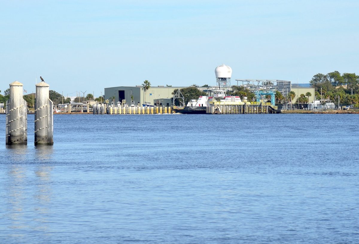
NOAA predicts November's highest tides Nov. 23-28 at St. Augustine Beach, Mayport and Fernandina Beach. See peak heights and times. Shown: file photo of the Mayport ferry landing and shoreline across the St. Johns River in Jacksonville; no flooding shown. Photo: Olga Ernst / Wikimedia Commons (CC BY-SA 4.0)
JACKSONVILLE, Fla. - Northeast Florida's highest predicted tides of November 2026 will arrive around Nov. 25, with National Oceanic and Atmospheric Administration (NOAA) predictions showing a 6.52-foot high tide at St. Augustine Beach, 6.06 feet at Mayport and 7.71 feet at Fernandina Beach. NOAA tide predictions show a smaller period of elevated tides Nov. 7-9, followed by a longer stretch of higher tides Nov. 23-28. The figures represent astronomical tide predictions, not forecasts of coastal flooding, and do not account for weather conditions such as wind, rain or storm surge.
The late-November predictions follow an Oct. 26 coastal flooding event in St. Augustine, when king tides combined with rain, wind and a nor'easter to inundate streets near Flagler College and City Hall, according to Jacksonville Today and News4JAX. NOAA's November data identifies Nov. 25 as the highest predicted tide date at all three monitoring locations examined. NOAA's predictions also show the highest tides exceeding each station's average higher-high-water level by approximately 1.1 to 1.4 feet.
Why Northeast Florida's November Tide Predictions Matter
The late-October flooding in St. Augustine demonstrated how unusually high tides and weather conditions can occur together. Jacksonville Today and News4JAX reported that king tides, rainfall, wind and a nor'easter affected streets near Flagler College and City Hall on Oct. 26. The flooding preceded another period of elevated astronomical tides predicted for November.
St. Augustine's chief resiliency officer, Jessica Beach, explained that the city's storm drains depend on gravity, according to the Oct. 27 reporting. That drainage process becomes less effective during king tides. News4JAX reported that the October water was about 2 feet above what was expected, because weather was added to the astronomical tide. That is why a predicted tide height is a starting point rather than a flood forecast.
NOAA's November predictions provide specific times and heights for expected high tides at coastal monitoring stations. They do not predict rainfall, wind-driven water levels or storm surge. The highest astronomical tide prediction therefore should not be interpreted as a prediction that flooding will occur.
The November data identifies two periods of interest for Northeast Florida. The first falls Nov. 7-9, when high tides increase at the stations examined. The second extends from Nov. 23 through Nov. 28, with the highest predicted readings occurring Nov. 25.
What NOAA Means by a King Tide
NOAA describes "king tide" as a non-scientific term commonly used for exceptionally high tides. According to the agency's National Ocean Service, unusually high tides tend to occur around new and full moons, when the Moon is closest to Earth, and during certain seasons. The term describes unusually high astronomical tides rather than a separate type of weather event.
NOAA maintains tide prediction data for monitoring locations along the Northeast Florida coast. The figures examined for November come from NOAA's Center for Operational Oceanographic Products and Services. They are expressed in feet relative to Mean Lower Low Water, or MLLW, a tidal reference level.
The November predictions identify expected high tides using astronomical calculations. Weather conditions are not included in those values. Consequently, the predicted heights describe the expected astronomical tide at each station rather than the complete range of water levels that could occur.
The figures also differ between monitoring locations. St. Augustine Beach, Mayport and Fernandina Beach each have their own tidal reference measurements. NOAA's data allows comparisons of predicted heights against each station's normal higher-high-water level.
November's Highest Predicted Tides: Dates, Heights and Times
NOAA predicts the highest November tide at St. Augustine Beach will occur Wednesday, Nov. 25, at 8:02 a.m., reaching 6.52 feet above MLLW. At Mayport's Bar Pilots Dock station, the highest prediction is 6.06 feet at 8:42 a.m. the same day. Fernandina Beach has the highest numerical prediction among the three stations, with 7.71 feet at 8:55 a.m.
The following table lists the highest predicted tides around Nov. 25, using NOAA station predictions. All times are local clock time, and heights are measured in feet relative to MLLW. The figures represent predictions, not observed water levels.
| Date | St. Augustine Beach | Mayport | Fernandina Beach |
|---|---|---|---|
| Nov. 23 | 6.14 ft, 6:23 a.m. | 5.77 ft, 6:59 a.m. | 7.36 ft, 7:09 a.m. |
| Nov. 24 | 6.40 ft, 7:12 a.m. | 5.97 ft, 7:49 a.m. | 7.60 ft, 8:01 a.m. |
| Nov. 25 | 6.52 ft, 8:02 a.m. | 6.06 ft, 8:42 a.m. | 7.71 ft, 8:55 a.m. |
| Nov. 26 | 6.49 ft, 8:54 a.m. | 6.03 ft, 9:35 a.m. | 7.68 ft, 9:51 a.m. |
| Nov. 27 | 6.32 ft, 9:48 a.m. | 5.90 ft, 10:29 a.m. | 7.54 ft, 10:48 a.m. |
Source: NOAA CO-OPS tide predictions for stations 8720587, 8720218 and 8720030.
The figures show a similar pattern at all three locations. Predicted heights increase from Nov. 23 through Nov. 25 before beginning to decline. The Nov. 26 readings remain close to the Nov. 25 peaks at each station.
At St. Augustine Beach, NOAA predicts 6.04 feet at 10:42 a.m. Nov. 28. Fernandina Beach is predicted to reach 7.31 feet at 11:44 a.m. that day. These additional predictions extend the period of elevated tides beyond the dates shown in the table.
The Earlier Nov. 7-9 Period of Higher Tides
Before the late-November peak, NOAA predicts another period of elevated tides from Nov. 7 through Nov. 9. The St. Augustine Beach station shows a predicted high of 5.80 feet Nov. 7, rising to 5.87 feet Nov. 8. The Nov. 9 prediction is slightly lower at 5.85 feet.
Mayport follows a similar pattern during the earlier period. NOAA predicts 5.69 feet at 6:59 a.m. Nov. 7 and 5.73 feet at 7:43 a.m. Nov. 8. The predicted Nov. 9 high is 5.69 feet at 8:23 a.m.
Fernandina Beach's Nov. 8 prediction is 7.30 feet at 7:53 a.m., according to NOAA. That height is below the station's late-November peak of 7.71 feet. The difference illustrates the two periods of elevated predicted tides during the month.
The early-November predictions are lower than those for Nov. 25 at all three locations. At St. Augustine Beach, the Nov. 8 prediction is 0.65 feet below the Nov. 25 peak. At Mayport, the corresponding difference is 0.33 feet, based on NOAA's predictions.
The Nov. 7-9 period and the Nov. 23-28 stretch are separate intervals in the published tide data. Both feature higher astronomical tides compared with some other November dates. Neither set of predictions establishes that coastal flooding will occur.
How Much Higher Than Normal Are the Nov. 25 Tides?
The highest predicted tide at each location can be compared with the station's Mean Higher High Water level. NOAA uses this tidal datum to represent an average of the higher high waters. Comparing that reference with the Nov. 25 prediction shows how much the forecast astronomical tide exceeds the station's normal higher-high-water level.
At St. Augustine Beach, NOAA's station data places Mean Higher High Water 5.14 feet above Mean Lower Low Water. The Nov. 25 prediction of 6.52 feet is therefore approximately 1.38 feet above that reference. This is the largest difference among the three stations examined.
At Mayport, the average higher-high-water level is 4.95 feet above MLLW, according to NOAA station data. The predicted Nov. 25 peak of 6.06 feet exceeds that level by approximately 1.11 feet. The comparison uses the station's own tidal reference values.
Fernandina Beach has an average higher-high-water level of 6.56 feet above MLLW. Its Nov. 25 prediction of 7.71 feet is approximately 1.15 feet higher. The result is similar to the differences calculated for Mayport and St. Augustine Beach.
| NOAA station | Normal higher-high-water level | Nov. 25 prediction | Amount above normal |
|---|---|---|---|
| St. Augustine Beach | 5.14 ft | 6.52 ft | +1.38 ft |
| Mayport | 4.95 ft | 6.06 ft | +1.11 ft |
| Fernandina Beach | 6.56 ft | 7.71 ft | +1.15 ft |
These calculations use NOAA's published station tidal datums and predicted high tides. The comparison measures astronomical tide height relative to average higher-high water at each location. It does not establish a flooding threshold or account for additional weather-related water level changes.
Why Predicted Tide Heights Are Not Flood Forecasts
NOAA's tide predictions are based on astronomical factors rather than changing weather conditions. The figures do not incorporate rain, wind or storm surge. As a result, the published predictions cannot independently determine whether flooding will occur during the Nov. 23-28 period.
The October flooding in St. Augustine involved a combination of king tides and weather conditions, according to Jacksonville Today and News4JAX. That event provides context for why astronomical tide predictions alone do not describe all coastal water level conditions. The November NOAA figures should therefore be understood as predicted tides rather than observed or total future water levels.
The tide stations also have different reference levels, making direct comparisons of numerical heights potentially misleading. Fernandina Beach's 7.71-foot prediction and St. Augustine Beach's 6.52-foot prediction are both measured relative to each station's MLLW datum. Comparing each prediction with its station's average higher-high-water level provides a more consistent view of how unusual the predicted tide is locally.
NOAA's tide prediction information is available at tidesandcurrents.noaa.gov. The November data includes predictions for St. Augustine Beach, Mayport and Fernandina Beach, with local times and heights relative to MLLW. Across those three stations, Nov. 25 is the highest predicted astronomical tide date of the month.
Sources: NOAA Center for Operational Oceanographic Products and Services (CO-OPS); NOAA National Ocean Service; Jacksonville Today; News4JAX
News organizations may republish this story with credit. See our guidelines.
Know someone who'd want to read this? Email it to a friend.
Own a Jacksonville business? Introductory ad rates from $125/month. See ad options Follow Jax Times on FacebookLocal news, events and people, in your feed every day.Most read this week
- JSO Opens New Headquarters at 532 Riverside Ave.: 346,000 Square Feet, 11 Floors and More Than $20 Million
- Duval's 1-Mill School Tax Renewal and 3 School Board Races on the Nov. 3 Ballot: Who Is Running and What's at Stake
- Florida's Lemon Law in 5 Steps: The 24-Month Window, 3 Repair Tries and How Drivers Get a Refund or New Car
- Jacksonville Building Permits in 7 Steps: When You Need One, Fence Height Limits and the $250 Fine for Skipping It
- How to Register a Boat in Northeast Florida in 6 Steps: Fees From $5.50 to $189.75 and a 30-Day Deadline
More stories
 Community Fort Matanzas by the Numbers: A 50-Foot Coquina Tower, 1742 Cannon Fire and a Free Ferry South of St. Augustine
 Local St. Johns County's $191.8 Million SR 207 Water Plant Is Running, Built to Save 13 Billion Gallons
 Education 27 St. Johns County Schools Named Florida Schools of Excellence as District Earns Top State Label
 Local Fort Mose at 288: The 1738 Settlement Near St. Augustine Was the First Legally Sanctioned Free Black Town in the U.S.
Comments
Be respectful. No personal attacks, hate speech, spam or anyone's private information. Every comment is reviewed before it appears. Comment rules
No comments yet. Be the first to share your thoughts.